The ride from McClellanville was very SLOW. Due to the time of the month, the tides were just not in our favor. If we had been able to be in Georgetown just before low tide there we would have had a push the entire way to Myrtle Beach. As it was, we ended up fighting the current the entire way. Doesn't seem like a big thing but if you loose even 1 mph you loose 8 miles over 8 hours which means another hour of travel. But what can you do?
The waterways of northern South Carolina have a new look. Lots of trees and less marshes.
These are pretty small waterways relative to other parts of the ICW. Lots to see along the way. Steve spotted 2 alligators and 3 deer - looked like Ohio whitetail deer only a lighter color - one with a spotted fawn. Good spot job!
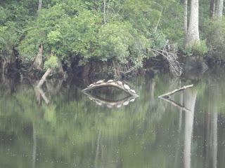
There were also lots of turtles along the waterway - sitting on logs along the side. Steve also spotted this group of turtles that to me look like a monster mouth with the reflection in the water!
And of course Steve had to have a picture of the giant dragonfly that was hitchhiking on the stay wire for the mast. Not sure if he wanted to go north but that's the direction we were going!
The ICW runs north of the actual town of Myrtle Beach but there is still evidence of money. Many huge homes but not the number of huge boats parked in front that we saw in places like Fort Lauderdale.
We finally made it to our marina almost at the end of Myrtle Beach. One of the marinas in this group of three is called Lighthouse Marina so I guess it's fitting that there is an actual lighthouse here.
Once again we passed the cruise gambling boats that operate out of Myrtle Beach. I loved the one which was named Aquasino! One of these days I'll find a place to play a few slot machines :-)
Starting out early in the day and heading directly east can definitely cause some issues as far as trying to see. It's not the sun so much as it is the reflection of the sun on the water. Sunglasses help but then it's harder to see the GPS and depth sounder. What a choice!
We had a great plan for the day today. After spending time studying the currents and tides the plan was: leave at 8 am. This would give us current going our way for at least a while. Arrive at Southport at the Cape Fear River at noon. But since the current on the river wouldn't change until 2 pm, we had no choice but to stop at Southport for lunch - our favorite place for seafood along the coast. Plus we could have spent the night at no charge. How can you go wrong with that? Best yellowfin tuna sandwich ever!!!
Once we had the current behind us, the 12 mile trip up the Cape Fear River was very easy. Even though the wind against the tide produces the usual wave action, it was a nice trip. This is a picture farther along the waterway where the incoming tide was meeting with water in an area that had no outlet. It was amazing how definitive the line between the two bodies was.
After a quick bike ride around the area (we already have our breakfast place picked out :-) ), it was time to change the engine oil. This is an every 200 hour thing so about every 1400 miles. Sometimes I really think we are just pretty slow in the uptake. Used to be that I had to get down by the engine, maneuver around with the drill pump and an empty oil container to drain the oil out. Gosh - why not run a hose so we could just do all of that in the aft cabin? HOW MUCH EASIER!!! Definitely one of those constantly annoying things that we took care of.
So this blog uses the new interface that I am reluctantly changing to. Hopefully the pictures will be easier to see. We'll see.
Thursday, June 14, 2012
Subscribe to:
Post Comments (Atom)


No comments:
Post a Comment