Tuesday, May 31, 2011

Tuesday May 31: Chesapeake City, MD

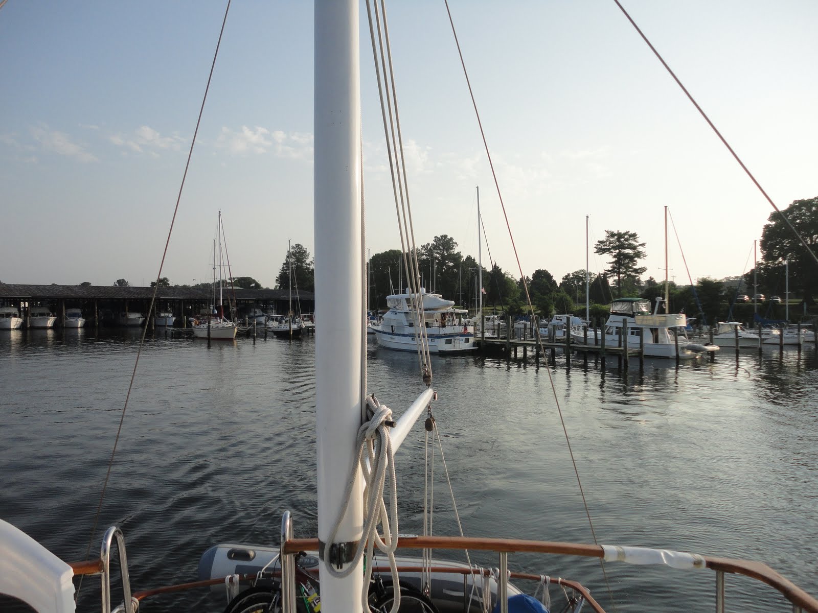
Dave and Joyce will be proud of us - we pulled out of Kentmorr Marina at 5:34 this morning! We were very surprised at the amount of current in the Chesapeake Bay as it would seem that with such a large body of water, the tides wouldn't do much. Wrong! So in order to make the best use of the current, the earlier we started the better. As it was, the current turned against us about 2 hours into our 7 1/2 hour cruise. Another sunrise on the water! It's getting to be a habit :-) Chesapeake City is a small town on the C & D Canal - which we will transit tomorrow. It's hot again - as once more the entire east coast (including Ohio, I see) has record highs. The city has a dock which is free and electric for the day/night is $15. Great deal and tonight is 1/2 price pizza at the restaurant right in the harbor. Sounds like a winner to me. More pics from Chesapeake City tomorrow.
Shortly after leaving this morning we passed under the Chesapeake Bay Bridge - what an engineering feat! We've seen many bridges but this one has been the best in a long time. Double click on the middle picture to see all of the birds sitting on the bridge cables! This bridge is what opened up Kent Island to development - especially housing for people who work in DC or Baltimore (so says the guidebooks anyway). The osprey are back full force at the northern end of the bay. Almost every red floating buoy has a pair that is nesting. Not so much on the green buoys even though the only difference in them is the color. Interesting ......
Finally, we have reached the end of the Chesapeake Bay! It narrows down to a small creek through which the C & D canal was built. Severe weather is forecast for tomorrow afternoon so we may end up moving a short 15 miles to Delaware City before attempting to travel down the Delaware Bay as there is very little opportunity to get out of weather. And Delaware City sounds kind of fun anyway. May end up being there until Friday though. Oh well -

Monday, May 30, 2011

Monday May 30: Kent Island, MD

We're now about 2/3 of the way up the Chesapeake Bay having traveled 45 miles yesterday and another 46 today. Tomorrow we will make it to Chesapeake City on the C & D Canal (connects the Chesapeake Bay with the Delaware Bay) and hope to be in New York City by the weekend. Cities we have bypassed for now: Washington DC, Baltimore and Annapolis. The plan is to stop at some of these in the fall when we return south. The solid lines are travel the last few days and the dashed lines are the travel for the next several days!
As we left Tangier Island yesterday (again at sunrise - we need to start sleeping in!), the water was a bit choppy again but again at our backs. We passed a strange sight that I kept looking at but couldn't figure out what it was - a lighthouse that wasn't on the charts? Or what? Turns out it was several ships that are apparently used as target practice. Wonder when they do the shooting??? We spent the night at Calvert Marina in Solomons, MD (there was a line of buoys across the Bay that marked the border of VA and MD. Strange!)
Off again this morning about 7 am. Dave and Joyce have gotten us in the habit of moving early! They decided to stay another night at Solomons to see friends and then they are going to have some work done on their boat that will take several days to complete so we left this morning without them. They are a wonderful couple and we really enjoyed traveling with them - I'm confident that we'll meet up again - somewhere on the Erie Canal perhaps. I am still in awe of them at 70 years young to buy their first boat and a 39' Mainship trawler to boot!!
It was a very calm morning with almost no wind and temperatures in the 90's by early afternoon. Lots of pleasure boats out on the lake as it seems everyone was headed home after the long weekend. The plan was to go further than we did but it was just too hot - even on the water. By 2 pm we were tied up with the air running and all of our shade structures up to provide shade for the boat (well actually to help the air keep the boat cool). Large freighters are still around. I don't know if the ones anchored are headed to Baltimore but that's my guess.
It's now official: we joined the America's Great Loop Cruisers Association (AGLCA) and have plans at this point to complete the circumnavigation of the Eastern US. Having traveled counterclockwise from NY, we'll complete the Great Circle Loop when we are on the Erie Canal this summer. The official flag raising was a few days ago! (Up until this point we have been half-loopers: going south and staying there!)

Sunday, May 29, 2011

Saturday May 29: Off the Grid in Tangier Island, VA

It was a record early morning departure of 5:55 am from Norfolk with a destination 75 miles up Chesapeake Bay to Tangier Island. The departure from Norfolk again showed the massive Naval presence with the number of naval vessels in the area. Chesapeake Bay is about 200 miles long from south to north so our destination will put us a bit less than 1/3 of the way we need to go. There are large freighters that we can see through the mist as we continue our way north. Finally about 2 pm we spotted land! Tangier Island is very low and is losing it's land to the Bay at an alarming rate of speed. We had the wind at our backs – which helps our speed but makes for a long day of constantly fighting to keep the boat on course as the waves push are moving faster than we are and tend to push us to one side or the other. Flies are also a problem when traveling with the wind. Solution? Hanging bags of water with a penny (or nickel) in it! Don't laugh – it works!!! When we arrived, 80 year old Milton Parks (owner of the marina) gave us a tour around the island in his golf cart. What a throw back this place is and what a trip he is! Says he's been married 59 years to the wrong woman :-) As is usual anymore, a nice sunset. I loved the speed limit sign below – and checked by radar to boot! There are very few cars on this island (2 ½ miles by 1 ½ miles) as most residents use golf carts, bikes or minibikes to get around so I think the sign is just funny :-) The third pic is of a sign which gives a bit of history of the island. Mail and supplies arrive twice a day by boat as well as two passenger ferries (one from the west side of the bay and the other from the east side of the bay) each day. We rode our bikes to the beach at the south end of the island. The sand was very soft and it was a lovely beach. Steve, of course, walked all the way to the end. I enjoyed my snooze waiting for him! We saw a small Fozzi dog at the beach – really cute – about ¼ the size of the real Fozzi though. Very soft and fuzzy. He came over and tried to pee on the bush I was leaning on! I didn't like him so much then :-) There are many cemeteries on the island – some of which are clearly family plots and are in the front or side yard of the homes. The surnames are few in number as it seems you are born here and stay or leave forever. Crockett, Parks, and Dise were some of the ones we saw had many graves. It's still quite warm. Steve found a battery powered fan with a spritzer bottle in one of the souvenir stores – it works great! Good idea, Wendy :-) The crab boats are plentiful of course as that is the mainstay of the way of life here. Even that is at jeopardy with the ill health (but improving) of the Chesapeake. Everything is about crabs (soft shelled) as is evidenced by the chairs at the museum in town. The bench to my left is the ONLY place in town that had any kind of an internet signal and we have had no phone signal for 3 days. Talk about being cut off!! Good thing about the crabs though: crab cake sandwiches are plentiful and good. We ate lunch both days at the dock (where ferries arrive) and loved it. A dinghy ride was in order to check out the rest of the area. Not much around so it was not a very long ride. Lots of crab shacks (where the 'watermen' have the crabs and watch them to collect the crab just after it sheds it's shell) around the harbor. It's a fun area – you can see the church and water towers from everywhere. Back to the dock where Yesterday's Dream is sitting at the Parks Marina.
Tomorrow early (6 am) we are off as the weather seems to be stable enough again to travel. Destination will be the Solomon's (on the west side of the Bay). Since I can't post this blog tonight, the info will be a day late but here it is anyway! :-)

Wednesday, May 25, 2011

Wednesday May 25: Norfolk, VA

We made it to Norfolk (Virginia!) about 2:30 yesterday – temperature in the high 80's (in the shade) so we immediately plugged in to a marina and turned on the air conditioner – it's just too hot to even be outside. About an hour and a half later, the storm arrived. A long story but the bottom line was the window over the computer was open and the wind and rain, of course, was pounding that side of the boat. Result? Once again, a wet computer (have we seen this before? Yep.). Removed the battery and let it dry out – lucky again as it seems fine. The storm that left as quickly as it came was one crazy wind and rain. The Irish Rover – a tour boat that leaves from the dock just in front of us – was on it's way to the dock. The captain decided against trying to dock which was a good idea. In trying to turn into the wind though it looked like the ship could just be rolled right over. Luckily it didn't and they were able to ride out the storm and get back to the dock. A great memory for the tourists to take home!
On the way here from Elizabeth City, we passed through the Dismal Swamp (for info: http://en.wikipedia.org/wiki/Great_Dismal_Swamp )– now a national wildlife preserve. It was really interesting – for the first 10 miles or so. Total length: about 22 miles! Here's a couple of pictures of us going through the swamp. We also have been seeing Canadian geese again. Funny that they aren't in the more southern states.
The picture at left: how do you know when the piling you are seeing might not be the best place to which to tie? When you see a small tree beginning to grow out of it!
There was a visitor's center but not open on Mondays, of course. We still spend a very pleasant afternoon at the rest area dock (the rest area is really for the nearby highway but they provide a dock for boater free of charge). It was very nice in the shade so I took advantage of it and finally took the time to read the Fort Sumtner brochure we had picked up in Charleston. Yesteday we then passed the “Welcome to Virginia” sign in the waterway!
While it was still cool this morning, we took a ride around the downtown area. Norfolk's art thing is mermaids. We think the one in the fountain was likely the inspiration for all of the ones we saw around town. Steve was particularly fond of the one below :-) There was also a Welcome Center designed and paid for by the Taiwanese government. Sister city or something. It was pretty fun – koi pond and fountain to boot.
The naval presence is HUGE – very similar to San Diego. I'm not sure which is bigger. We passed many navy ships on the way to the downtown area including an aircraft carrier. The information on the USS Wisconsin was very interesting (see plaque – double click) and the ship itself of course was huge. From the front though it was the skinniest thing! third picture is the ship taken from the front. Really shocking to see!
We leave tomorrow morning and head up the Chesapeake Bay. Not sure where we are staying yet but I'm sure we'll figure it out!